
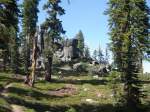
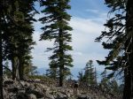
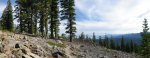
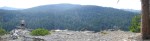
Views from Mt. Watson
Try this on for extra sucky- 26.5 miles, about 3800′ of climbing, long climbs, views galore, and rippable wide open foresty to rocky descents. This ride has it all and is a Tahoe Sux classic adventure.
This is one of our favorite rides out of Tahoe City.

H- Checking out the Truckee river valley.

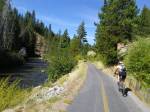
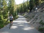
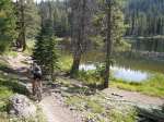
Warm up cruise along the Truckee River
The 64 Acres parking area in Tahoe City is the start of this ride. Warm up for long climbs with a 4 mile spin on the bike path along the Truckee River, before beginning the long climb up to Mt. Watson via Western States Trail. You’ll climb a mix of singletrack and seldom used OHV road to the Fibreboard Freeway.

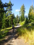
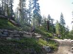
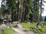
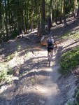
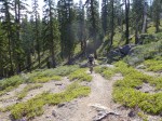
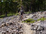
Climbing Western States trail
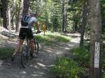
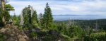
Upon reaching the Fibreboard Freeway at around 11 miles (a section of paved road at 7700′), you’ll turn east (left) toward Starrett Pass (and Soup Station #1). Enjoy the flattish spin and north facing views. Pass the paved turnoff to Watson Lake and look for a slightly marked singletrack on the right side. This is the dirt option to go to Watson Lake via the TRT.

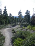
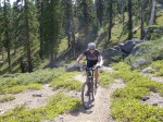
Climbing to Fibreboard Freeway
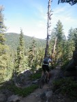
You’ll round Watson Lake and climb to around 7900′ before a great, loose, bouldery technical descent. Epic views greet you along the way. Another traverse with south facing views of Tahoe and you’ll be greeted with another fast descent. Climb, descend, Repeat. The ride finishes up with 5 miles of mostly descending back to Tahoe City with views of the Truckee river great rock formations, and cliffs.

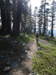
Classic Tahoe Singletrack- views, granite, forests, long climbs.

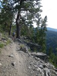
H- Enjoying the views from the Fibreboard Fwy

Lightly marked singletrack along the Fibreboard

Even the trees smirk in Tahoe
Ride Description and Details-
Length- ~26.5 miles
Elevation Gain- ~3800′
GPS Tracks- Garmin Connect Western States-Mt. Watson- TRT (Ignore the last 9 miles, I forgot to stop the tracks on the ride back home).
Where to Start-
This ride starts and ends at the 64 acres Parking Lot just south of the Tahoe City “Y” off Hwy 89.
Ride Description-
- Starting from the 64 acres parking lot, take the multi-use bike path toward Squaw Valley
- After approximately 4.25 miles turn right onto Western States trail (the entrance is just under a bridge underpass and fairly well marked.
- Climb, climb, climb. Western States is a great mix of singletrack, decommissioned logging road, and lightly used OHV road. Enjoy the views, mostly climbs, and the occasional fun descent.
- At around 9.5 miles, turn right onto a singletrack that climbs and winds its way to the Fibreboard freeway.
- Left turn (east) on the Fibreboard Freeway for about 1.3 miles. This is a paved road with north facing views. Bypass the paved Waston Lake turnoff and look for a lightly marked singletrack on the right.
- Right turn on the singletrack till you reach the Tahoe Rim Trail- TRT (again, a lightly marked intersection).
- Right turn on the TRT. Enjoy around 13 miles of great singletrack all the way back to the start! You’ll pass Watson Lake, Painted Rock, and enjoy winding climbs and great descents. There is nothing flat till you reach the end of the Tahoe Rim Trail.
Sweet!Tahoe Sux.

H- Rounding Watson Lake

TRT along the Truckee river valley
This is an advanced skill level ride because of the length, extended climbing, and some technical sections. This is a camelbak type ride (2 bottles are probably not enough water for this ride.). Bring energy food and lots of fluids! As with all our rides, do your own reality check with a map. I do not offer turn-by-turn directions, and there are many unmarked intersections. Go prepared with a map and solid navigation skills.

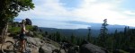
Views from near Painted Rock- 5 miles of descending ahead!
Always practice Backcountry MTB Ethics-
- Ride in Control. Everyone likes to rip it on the mountain bike. Don’t let your need for speed ruin another trail user’s experience.
- Ride it DON’T slide it! Locking up your rear wheel trashes trails and is an indication of poor riding skills .
- Pack it out. Never leave tubes or trash on the trail. Pack out someone else’s trash if you see it. Even banana peels, and bits of GU/powerbar wrappers have an impact.
- Yield to other trail users. Stop completely for all horses and communicate with their riders. Yield to hikers. Uphill riders have the right of way.
- Help each other out. Share directions, trail knowledge, and mechanical assistance.
- Set a good example. Your actions in the backcountry have a direct impact on future MTB access.
Gallery–
-
- Warm up cruise along the Truckee River
-
- Climbing Western States trail
-
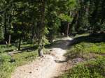
- Western States singletrack
-
- Climbing to Fibreboard Freeway
-
- Classic Tahoe Singletrack
-
- H- Enjoying the views from the Fibreboard Fwy
-
- Lightly marked singletrack along the Fibreboard
-
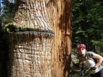
- Even the trees smirk in Tahoe
-
- H- Rounding Watson Lake
-
- Views from Mt. Watson
-
- Views from near Painted Rock- 5 miles of descending ahead!
-
- TRT along the Truckee river valley
-
- H- Checking out the Truckee river valley.
Share this:


This ride SUX!
LikeLike