This is Part 2 of the story of our bicycle tour from Salt Lake City to Albuquerque in 1999. I’m honored and humbled that Part 1 was selected for Freshly Pressed by WordPress. You can read Bike Tour- Salt Lake City to Albuquerque Part 1.


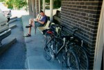
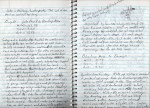
Thank goodness for journals. Interesting to read my chicken scratch after 12 years
When searching for more photos to scan from the trip, I uncovered my old trip journal. It’s interesting to see my notes from the trip, almost 13 years ago.

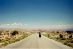
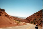
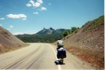
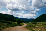
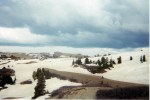
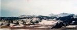
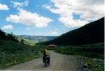
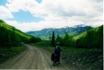
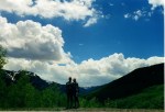
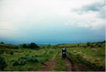
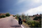
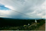
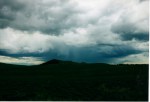
Long days in the saddle between Lake Powell and Durango
Since rediscovering my journal, I was able to piece together the two days from Lake Powell, Utah to Durango, Colorado. Looking back, it’s no wonder they were a blur. We put in two long, hard, hot days of 123 miles and 111 miles, respectively (averaging around 13.25 miles per hour both days). We were trying to make it from Lake Powell to Hovenweep National Monument in one day. At one point, (despite carrying nearly 2 gallons of water each) we ran out of water and had no choice but to backtrack 8 miles to fill up our motley collection of bottles again. There are few pictures from those two days, as we were trying to make up distance from the two days of rain where we took refuge up in Boulder, Utah.

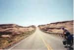
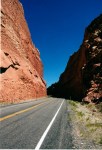
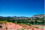
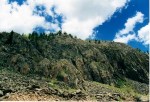
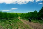
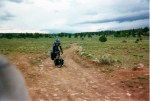
Roads carved through mountains of red rock
In Blanding, Utah, we ate at a place simply called “Patio.” A super cheap burger place (Cheap, big food is huge on a bike tour- especially for 20-somethings traveling on a tight budget). While we gorged ourselves on fried food, we decided to take dirt roads to Hovenweep National Monument and take obscure back roads into Colorado.
I wrote in my journal:
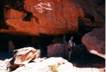
“The dirt roads were amazing. Across vast mesas and down into washes. We saw Native American cliff dwellings along the road, unspoiled by tourism.”

H checking out the cliff dwellings off the road. No historical markers, no signage, just a testament to times past.
We stopped and checked out the remains of Native American cliff dwellings and cave drawings inscribed into the red rock. There was no signage, no historical markers, no parking lot. There they were, a short hike off the dirt road; living history at it’s best. We looked, we saw, we took only a couple of photos.

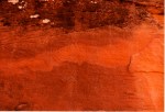
Cave drawings, faintly visible on the cliff walls

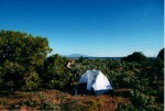
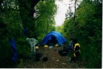
Camping on a mesa among the scrub with no water.
It became obvious that we would not make Hovenweep National Monument by nightfall. We set up camp among the scrub brush on a mesa and had a great dinner under the stars, miles from any streetlights. Unfortunately, we couldn’t spare any water to wash ourselves or our cookware, and had to try to sleep with the dirt and sweat of 123 miles of riding. It was a sticky, uncomfortable night in the tent under the stars.
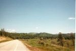
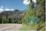
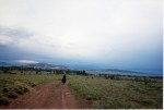
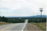
The next day we rode the final few miles to Hovenweep National Monument, washed ourselves and cookware as best we could, and drank copiously. We left Hovenweep into 10 miles of stiff headwinds before turning east toward Colorado. The only sign we had crossed into Colorado on the rural, two lane road was a change in the mileage markers. Within ten miles of crossing the Colorado border flowing water in creeks and streams returned, and trees returned to the hillsides. The deserts of Southern Utah are epic, and jaw dropping, but we were ready for trees, water, and greenery again.

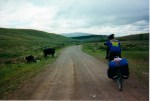
Wild horses on the back road to Colorado
We pushed quickly through Cortez, Colorado, stopping only for lunch. I wrote in my journal:
“Cortez was the biggest town we’d seen since Salt Lake. We hadn’t seen a stop light in nearly 700 miles.”

We soon left the desert scrub behind when we crossed into Colorado
Nearly seven hundred miles on the road without a stop light! In writing this post, I pulled out all my old maps and retraced the obscure roads we chose. My map of choice for back roads travel is the huge DeLorme topographic Atlas and Gazeteer (and a compass). Still, I’m not sure exactly how we navigated through the scores of unmarked, unmapped intersections. I think I’ve blocked out all the wrong turns we made. Navigating seems so easy now with GPS coordinates pinpointing your location down to a few feet.

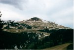
Durango, from the hills above town.

Laundry time in Durango
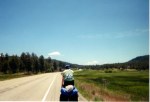
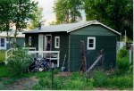
When we finally rolled into Durango to visit with H’s college friend Debster, we had put in three hard days through the desert and racked up 313 hot, dry miles through Southern Utah.
In Durango, we spent a couple of days in town visiting with H’s college friend Debster. We easily filled our time doing laundry, writing postcards, and cruising about town, happy to be unladen by panniers and camping gear. Durango was touristy, in the way many of many mountain towns. Nonetheless, we had a great time.
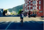
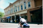
Food, on a bike tour is of paramount importance. We were probably burning somewhere between 5,000-8,000 calories a day. While bike touring, we made food choices not in our daily diet. One of those was the Western Sizzlin’ $7 all you can eat buffet in Durango. We spent three hours there, eating, writing postcards, eating, writing journals, and eating. We showed up in late morning as breakfast was being served, then ate lunch when they changed to lunch service. H showed some restraint, but I think I put down at least 6,000 calories in a single meal. We have few pics of Durango, except this one of me riding through downtown with the Colorado topo Atlas and a take-and-bake pizza strapped to the bike. Up the street is the billowing black smoke of a structure fire. Little did I know then that we would both “grow up” to be firefighters.

Riding through Durango with a Colorado Atlas, and pizza strapped to the rack (with a structure fire up the street).
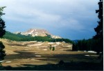
We left Durango determined to ride on the Continental Divide mountain bike route for a bit. We put in a 112 mile day, climbing over 10,857′ Wolf Creek Pass and crossing the Continental Divide for the first time on our bicycles. It was a long, tough climb, but gratifying to see overheated big rigs, cars, and RVs as we rolled by under our own power. Good thing we were rested from a our days in Durango and ready to hit the road. I mentioned eating everything in sight. We found a day old package of a dozen

Wolf Creek Pass. The first time we crossed the continental divide on our bikes.
assorted donuts for $0.99, a real find when you are on tour and on a budget. We climbed over Wolf Creek Pass fueled by discount, stale donuts and Coke. Of course this stellar food combo left H bonked and out of energy in no time, creating the “eat when H is hungry, not when S is hungry” rule. After a few low energy incidents, I figured out that H had to eat much more often than I did. Trail mix and peanut butter sandwich bites were the snacks of choice. I’m more like a garbage disposal- feed me 4,000 calories of junk, donuts, and coke and I’m good for hours. H needs quality food at regular intervals.
Traveling with H is great. We quickly fell into a routine of touring together, which has continued for years. We have our little “chores” of setting up and breaking camp. I filter water, set up the MSR stove and get dinner rolling, while H sets up the tent. I can’t think of anyone else with whom I could spend weeks or months living smoothly in a tent. She is also a stellar, tough-as-nails athlete, who routinely crushes me on the bike.
Sure, we have our not-so-happy moments, too. They are few, though. The stresses in our relationship are usually related to three things: cold, tired, or hungry.

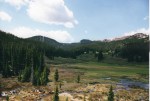
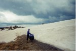
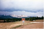
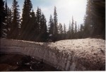
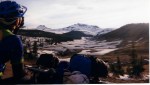
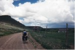
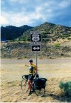
From South Fork, Colorado, we headed south to the Continental Divide mountain bike route. After climbing on a dirt road for nearly 20 miles to over 11,000′ elevation, we came to the Summitville junction and realized that our road was blocked by snow yet again. As I was sitting in the dirt, looking at the maps for an alternate route, a group of mountain bikers came through half riding, and half pushing their bikes through the snow. They were riding the Continental Divide mountain bike route on with their gear in trailers and had started at the U.S.-Mexico border. They said that there 25-30 large snowbanks, but it was possible. They also came with stories of incredible burgers and food in Platoro, 30 miles down the road.

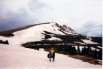
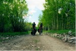
Climbing through aspen forests

Look Ma, No hands! H enjoying the aspens.
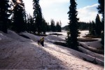
Suddenly, the impassable became passable! They had done the route finding for us and all we had to do was follow their tire tracks. Sounds easy right? It was one of the longest days I’ve been on the bike- 11+ hours to cover 50 miles. Pushing and pulling the bikes through long patches of snow above 10,000′ elevation. We made the final push over Grayback Pass at 11,924′ elevation. Turns out that mountain bikes with trailers and wide tires are better suited for the snow than touring bikes with panniers and skinny tires. In many spots our tires immediately sunk into the snow up to the hubs, and we would posthole in the snow up to mid-thigh trying to lift the bikes out. I gave H my Goretex socks, but our shoes were already soaked with and filled with snow.

Uh oh!

H slogging through the snow

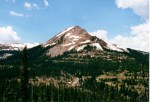
We tried to hike up to Grayback Mountain (just to say we hit 12,448′) but were chased down by thunderstorms and lightning.

More slogging through snow. Not so much fun at this point.

We had no idea we were riding by one of the worst environmental disasters in U.S. history
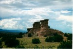
Along the way, we passed through the Summitville mine and Superfund Site. We didn’t know it at the time, but Summitville was perhaps the worst environmental disaster in Colorado history, and one of the most costly environmental disasters in U.S. History (in excess of $200 million dollars to mitigate cyanide leaching downstream into the Alamosa River, killing everything downstream). It was a strange scene. Here we were, riding through incredible Colorado beauty and scenery only to accidentally stumble upon a massive open pit mine. The Summitville mine had been in operation on and off since the 1870s. When we rode through, the roads were still unplowed and the place looked abandoned. Old mining shacks sat dilapidated next to modern tractors and cleanup equipment. Strong blasts of sulfur would assail our noses us as we rode closer to the mine, and warning signs were everywhere. Of particular concern to us was that we couldn’t filter drinking water. Every creek and drainage had “Contaminated” signs posted prominently. We did not know it was, but avoided the water anyway.

Open pit strip mining

Mining shacks abandoned decades ago stood next to the modern mine

Shortly after the toxic dump into the Alamosa River, the mining company abandoned the mine and declared bankruptcy, leaving taxpayers with outrageous cleanup costs.

Despite hours on the bike, we couldn’t filter water. Every stream had warning signs about contamination.

One last mine photo. Looking back at the mine, you can see that the entire peak of the mountain was “cut off” by the mining operation. Straight lines like this rarely occur in nature.

Rest stop along the way. Here I am, sitting in the dirt and eating everything in sight.
It was on this day that I learned an important lesson: Never leave your partner. We were still a few miles outside Platoro, when evening began to creep up on us. We realized that the Platoro Inn might be closed when we get there. The stories of incredible range fed burgers, and a warm bed were pulling me like a mule to a carrot (we were also above 10,000′, had little food, and temps would dip into the 20s). I suggested to H that I go ahead and book a room and order food. She reluctantly agreed, and I was off, hammering out of the saddle (as much as you can on a loaded, 70 pound bicycle) in search of bed and burgers as darkness fell. I left a flashlight on the road at the intersection. I arrived at the Platoro Inn, made sure they were open and headed back out to get H. H was just a couple of minutes behind, but had been riding by herself on unknown roads in the dark for some time. Everything worked out fine, but leaving H was a mistake I still think about today. Any number of things could have happened.

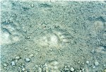
Large bear tracks were common on the road.
H has this to add:
“All I could think about riding alone was: “Was that a bear? What was that noise, a bear?!?!?! Am I going the right way? Did I miss a turn? Is that a bear?!?!?” All I can say is that the burgers and the Cowboy Room was worth it, as I saw no bears.”
I hadn’t mentioned that we were in bear country. We saw many large bear tracks on the road. They were probably just black bears, but we didn’t have much experience with them.
Unless there is an emergency, never leave your partner during unfamiliar backcountry or back roads travel. Just missing a turn can be disastrous, or at the very least cause unnecessary stress. We’ve applied this lesson consistently for many years now. We always regroup at intersections, and usually keep each other in sight or earshot in unknown terrain.
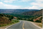
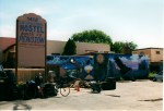
Incidentally, the burgers in Platoro were great and we got a great room and hot shower in the “Cowboy Room.” The next morning we had a leisurely breakfast, worked on the bikes, and started the day with a 23-mile dirt descent into Antonito, Colorado (we started around 10,000′ elevation). What a day! Stunning terrain, flowing water, aspens, meadows choked with wildflowers, unbelievable rock formations, and snow-covered peaks. Colorado at it’s finest. It was so incredible that we took 5 hours to go 35 miles, mostly downhill (many stops and WOW! moments). We stayed in the hostel in Antonito Colorado and got a private little cabin for $8/night each including breakfast. Hostels are still a great way to travel.

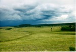
Rocks and clouds

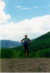
Look Ma, No Hands!

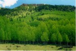
Incredible stands of aspens- I can only imagine the sea of color in the fall.


Our little cabin at the hostel in Antonito- $8/each for a private room with breakfast, an incredible deal.
The next day, we had a great breakfast of pancakes with diced apples and granola in them. Once again, we took the road less traveled and chose to take dirt Forest Service Roads into New Mexico only to be cut off by a thunderstorm and pelted by rain and gravel-sized hail for hours as thunder and lightning boomed all around us. We set up camp early and listened to the little one speaker AM/FM radio in the tent. Unfortunately, there was no water nearby and I had to ride back three miles and filter water from a cattle pond- by far the worst quality water I’ve ever had to choose. Needless to say, we boiled everything.

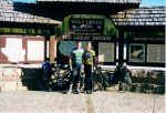
The great people at our hostel. We socialized with them over breakfast. They marveled at how much we could eat.
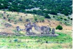
One of the things about riding rural/backountry roads is the sense of forgotten history you see along the road. We rode by abandoned ranches and homesteads, left vacant decades ago. Often, hand laid rock walls were the only evidence of lives past. Who were these people, and what were their stories? They invested blood, sweat, and tears into the land in hopes of prosperity in the American West, only to pack up and abandon the land.

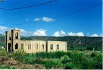
One of my favorite images from the trip. The shell of a church, alone in the sage.

The rural American West is often a story of people in search of better lives. Summitville, the EPA Superfund mine we rode by once had a population of 700 people living in harsh conditions at 11,000′. The remains of towns, ranches and homesteads tell a silent story of hope in harsh country.

Old homesteads among the mesas. A testament to tough people and broken dreams.

Ruins among the scrub. I love how some of the hand laid rock arches are still standing.
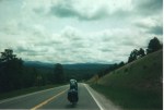
The following day was epic yet again. My journal says it best: “One of the best days yet. Began the day with 38 miles of outstanding dirt roads, stunning aspen meadows, big ring descents, the works! We dodged thunderstorms and watched massive lightning strikes all around us. The dirt ended with an 8-mile fast doubletrack descent to icky Hwy 285 into Tres Piedras. The final 30 miles into Taos was mostly tailwinds with long sections above 30mph till we crossed the Rio Grand Gorge and had horrible cross winds for the last 20 miles.”

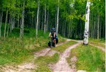
Riding through aspens in Carson National Forest

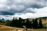
Dark skies, passing thunderstorms, and rural roads made for epic riding.

Family photo (staged). H held the bikes, while I set the timer and sprinted back to the bike. Still, nearly 40 miles of roads like this today.

I love this scene. The adobe church had been recently painted despite being unused for years. Outside, the cemetery sits, unkempt among the sage.


Carson National Forest, NM. Looking back at some of the pics, we were really out in the middle of nowhere, and loving it.
Taos was a bit of culture shock. We crossed into New Mexico on isolated, scenic dirt roads with zero traffic. In one day we crossed into a kitschy tourist mecca with a gaudy, artificial feeling southwest theme. My impression of riding into the populated areas of New Mexico was one of poverty and it’s accompanying litter. Suddenly, the roads were strewn with trash. On several occasions we saw people fling trash out car windows, like it was no big deal. We stopped at the grocery store in Taos and scored a bag of mixed veggies for $0.99. and a big bag of bread rolls.

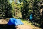
Drying out our gear and clothes from our roadside campsite. We couldn’t see much while setting up camp in the dark and rain, but it turned out to be a nice spot.
On the way out of town we learned another good lesson for bike touring: If it’s nearing dark, and threatening rain- don’t try to get extra miles. We passed up good camping trying to get extra miles, and felt unsafe for the first time on back roads. A few times, cars slowed down and it’s occupants leered at us with an evil eye, sometimes passing us 2-3 times. H and I both had a bad feeling about riding around here. To make matters worse, a light rain turned to a heavy downpour as we struggled to find a spot to camp that was invisible from the road. We finally found a place and set up the tent in the dark under a drenching rain. I hurriedly tried to cut little drainage trenches around the tent as water flowed across the ground. Those veggies and bread we bought? We made a great dinner of hot soup and bread, while listening to the roar of rain and thunder on the tent. The next morning we woke up to dry skies.

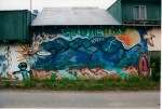
Mural in Truchas, NM
In writing about New Mexico, I almost feel guilty; like I’ve given it a bad rap. After traveling for two weeks in isolated natural beauty, we were suddenly riding with traffic and littered highways. I’m sure there were better, less traveled roads, but we couldn’t navigate our way through with the patchwork of Indian reservations and dead end roads without taking long detours.

One of the hundreds of map checks of the trip. I think we had no choice here but to get on the freeway after hundreds of miles of country roads.
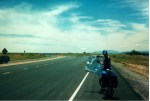
From our campsite outside Taos, we headed South to Santa Fe. Once again, we couldn’t find a way to navigate via back roads and wound up on Hwy 285 being buzzed by cars and trucks at 70 mph with no real shoulder. We rode as hard as we could trying to get through to smaller roads, afraid of being creamed by a big rig. Safely in Santa Fe, we checked into the hostel for two nights. Santa Fe was incredible; two nights were not enough. Music, Art, Culture, Architecture, Food. Santa Fe rocked and is on our list to revisit. We spent a day visiting museums, checking out the southwest architecture, and (naturally) eating.
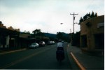
Our trip was winding down and we had one more day of riding into Albuquerque. We rode Southwest roughly along the Turquoise Trail and into Albuquerque along old Route 66. As we approached Albuquerque, we also encountered miles and miles of urban sprawl. Shopping centers, fast food chain restaurants, modular home and trailer sales lots, and car dealerships seemed unending. We nicknamed Albuquerque, “Sprawlbuquerque” after a few miles. We did not have enough time to find the nice parts of Albuquerque and leave with a different experience. Rolling into miles of urban sprawl after over 1,000 miles of country roads left a bitter taste.

Riding the Turquoise Trail on the last day

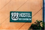
“Get your kicks on Route 66”
We spent two nights at the slightly seedy Route 66 Hostel (complete with cheetah print bedspread). A local bike shop gave us two bike boxes, and we packed up our bikes in a nearby park, took a cab to the airport and flew home.

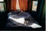
Cheetah prints and 70s curtains, yeah!

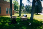
End of the road. Boxing up our bikes in the local park.
Writing a blog about a trip over a decade earlier brings a different perspective. Time makes the hard parts seem easier; the great parts remain great. If not for my journal, I would not have remembered the hours we spent sweating over baking asphalt through the desert, or the times we spent freezing in driving rain, or struggling to wrangle bikes through thigh deep snow at nearly 12,000′. Looking back, we had a crazy, physically demanding adventure. We did not set out to do something “extreme.” In the moment, taking the road less traveled just seemed like the thing to do.
In part 1, I mentioned that this trip set our relationship in motion. H and I have been together 13 years now- a relationship started by our love of riding bicycles. Growing older and having “real” jobs has not dampened our love of outdoor adventures. We’ve logged literally tens of thousands of miles together under our own power on roads, trails, snow, and water. We still dream about epic trips, although our ability to get away for weeks on end has diminished. Now, at a different point in our lives, we still try to have epic adventures- one big one a year, and shorter ones every chance we get.
If there is one message that I want to convey through this long story of our trip, it is this: Get out on your own adventures, large or small. Take the road less traveled. Life is not always about seeking comfort. Experience heat, cold, hunger, exhaustion, physical and mental challenges- they make all the other parts sweeter. Take pics and make memories. When you look back at your life, you won’t remember the time spent sitting in front of the TV or at the mall. You will remember the times you were totally present in the moment, pursuing the things you love.
Thanks for reading. More stories coming…
-
- H checking out the cliff dwellings off the road. No historical markers, no signage, just a testament to times past.
-
- Cave drawings, faintly visible on the cliff walls
-
- Long days in the saddle between Lake Powell and Durango
-
- Roads carved through mountains of red rock
-
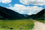
- Camping on a mesa among the scrub with no water.
-
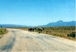
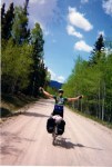
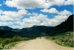
- Wild horses on the back road to Colorado
-
- We soon left the desert scrub behind when we crossed into Colorado
-
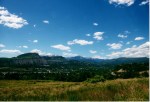
- Durango, from the hills above town.
-
- Laundry time in Durango
-
- Riding through Durango with a Colorado Atlas, and pizza strapped to the rack (with a structure fire up the street).
-
- Wolf Creek Pass. The first time we crossed the continental divide on our bikes.
-
- Climbing through aspen forests
-
- Look Ma, No hands! Helene enjoying the aspens.
-
- Uh oh!
-
- H slogging through the snow
-
- We had no idea we were riding by one of the worst environmental disasters in U.S. history
-
- Open pit strip mining
-
- Mining shacks abandoned decades ago stood next to the modern mine
-
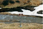
- Did I mention we couldn’t drink the water? Despite hours on the bike, every stream had warning signs about contamination.
-
- Large bear tracks were common on the road.
-
- One last mine photo. Looking back at the mine, you can see that the entire peak of the mountain was “cut off” by the mining operation.
-
- A particularly large snow bank. We had to heave the bikes up one at a time.
-
- More slogging through snow. Not so much fun at this point.
-
- Rest stop along the way. Here I am, sitting in the dirt and eating everything in sight.
-
- Rocks and clouds

-
- Look Ma, No Hands!
-
- Incredible stands of aspens- I can only imagine the sea of color in the fall.
-
- Family photo. Puffy clouds and Colorado skylines. Not shown is that we were standing on the edge of a cliff in a sea of wildflowers.
-
- Our little cabin at the hostel in Antonito- $8/each for a private room with breakfast, an incredible deal.
-
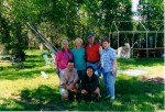
- The great people at our hostel. We socialized with them over breakfast. They were amazed at how much we could eat.
-
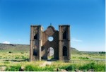
- One of my favorite images from the trip. The shell of a church, alone in the sage.
-
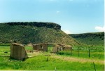
- Old homesteads among the mesas. A testament to tough people and broken dreams.
-
- Riding through aspens in Carson National Forest
-
- Family photo (staged). H held the bikes, while I set the timer and sprinted back to the bike. Still, nearly 40 miles of roads like this today.
-
- Dramatic skies.
-
- Carson National Forest, NM. Looking back at some of the pics, we were really out in the middle of nowhere, and loving it.
-
- Dark skies, passing thunderstorms, and rural roads made for epic riding.
-
- Bikes and cows
-
- Riding the Turquoise Trail on the last day
-
- Mural in Truchas, NM
-
- Drying out our gear and clothes from our roadside campsite. We couldn’t see much while setting up camp in the dark and rain, but it turned out to be a nice spot.
-
- More broken dreams among the scrub. I love how some of the hand laid rock arches are still standing.
-
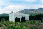
- I love this scene. The adobe church had been recently painted despite being unused for years. Outside, the cemetery sits, unkempt among the sage.
-
- One of the hundreds of map checks of the trip. I think we had no choice here but to get on the freeway after hundreds of miles of country roads.
-
- “Get your kicks on Route 66”
-
- Cheetah print sheets, yeah!
-
- End of the road. Boxing up our bikes in the local park.
-
- Thank goodness for journals. Interesting to read my chicken scratch after 12 years
Share this:


What an epic journey and how lucky to have after all this time the photos and your journal to bring back those memories. There are so many things I did back when I was younger that I didn’t document nor do I have any photos from those adventures. Just the snapshots I took in my head are reminders of those days. Thanks for sharing. My favorite photo is the green aspens. Take care and safe biking.
LikeLike
Love the photos. I do invite you to give Durango another visit, and spend some time away from Main and get to know the area. I spent a decade there and there is SO much more to the town and surrounding areas than the touristy stuff.
What a trip! Thanks for sharing.
LikeLike
Oh, we had a great time in Durango. The only thing we were missing is our mountain bikes. In fact, we love the mountain towns of Colorado. We’re pretty good at avoiding the t-shirt and knick knack shops and touristy stuff and finding interesting people and interesting adventures. We did a big road trip in 2010 through parts of Colorado, and could easily spend a summer in Western Colorado.
LikeLike
Living there, we avoided Main during the summer months, that’s true. I just have a love for that town! I blogged about it (“A confession”) and it was fun to remember some of my older memories. I was there when you came through.
LikeLike
Great Post – Great Photos – thanks for sharing!
LikeLike
What an amazing trip! Very, very cool!
LikeLike
Loved reading about your unique trip.
LikeLike
Read through both your posts about this journey and it was a wonderful read so I can only imagine how great the experience would actually be to live.
You mentioned how bike touring can really make or break a relationship and though traveling by car is no where near the same it can make or break a relationship too. Within 6 weeks of meeting my husband we drove round trip from Pueblo, Colorado to Point Reyes, California over a weeks time and this was only a week after I had done this same drive but over a weekend with 3 small children. It was a great time being able to spend that many hours together.
I moved from Pueblo to Las Vegas this last summer and I can say that in the 8 1/2 years I lived in Colorado I never saw the Aspens green like the pictures you had. I assume from the pictures and the weather it was spring time. We never traveled into the mountains in the spring because as you experienced, thundersnow is always a concern.
This was such an amazing compilation of posts that I am now excited to read about your other adventures. Thank you for sharing and I am glad you were Freshly Pressed again (re:Black Friday) so that I would happen upon your blog.
LikeLike
Wow- Thank you. When I began to write about our trip, the words flowed into the thousands. In hindsight, I should have broken up the trip into three, or perhaps four posts. But thanks for hanging in there on a long story. It doesn’t meet the common e-writing standard of 600-1000 words.
The photos of those aspens were taken in June- all above 10,000′ We were from coastal California and were just in awe of the scale of Western Colorado and Utah Landscapes.
Thanks also for your notes on Albuquerque. My biggest memory of Albuquerque after traveling obscure rural roads was strip malls, modular home dealerships, and fast food- repeated mile after mile.
Thanks again.
LikeLike
Oh and I forgot to point out that though I was in Albuquerque 10 years after you it is a horrid giant town and the only place that is decent is Old Town and even that is just a tourist attraction. So I don’t think your impression of it was really that far off. Even my friend whom has lived there for the last 14 years thinks its horrible and only stays because of her family,
LikeLike